Welsh Project Areas

3. Rhosneigr, Llyn Coron, Dinas Dinlle & Morfa Dinlle

News Letter

Location Map

Introduction

Welsh project area 3 encompasses a hugely diverse range of natural environments and heritage sites which are vulnerable to the impacts of climate change which include erosion and sea-level rise. The archaeological and palaeoenvironmental investigations undertaken by CHERISH within this area include coring of lakes to reconstruct millennial-scale environmental change, dating of sand movement events, seabed scanning, intertidal wreck surveying, and the excavation of an eroding prehistoric coastal fort. Archaeological evidence demonstrates that people have roamed and occupied this stretch of coastline for thousands of years. However, CHERISH is uncovering the dynamism of the coastal environment that has shaped not only the coastline but the lives of its inhabitants through combined palaeoenvironmental and archaeological investigations.

Rhosneigr

Aerial image of Llyn Maelog beneath the coastal village of Rhosneigr.

Rhosneigr is a small village occupying a bedrock outcrop on the southwest coast of Anglesey. Below the village is a 20 hectare lake known as Llyn Maelog which is separated from the beach by a 500m-wide sand-dune complex. The dunes rise to a height of about 20 metres immediately behind the beach Traeth Llydan. The lake is a significant ecological habitat for a range of plants, birds and animals, but  is also an important focal point for residents and tourists alike. It is surrounded by a diverse range of important archaeological sites such as burial tombs, settlement sites, and the site where 180 iron and copper alloy objects were discovered. Therefore, it seems likely that this substantial freshwater lake would have been a significant site in the past.
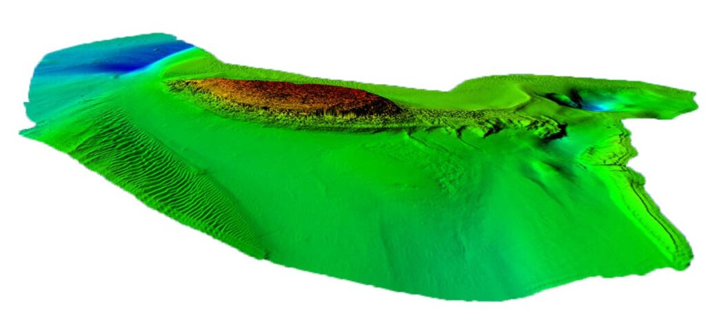
CHERISH has recovered cores of lake sediment in order to reconstruct the evolution of the lake and its surrounding environment. Pollen analysis has been carried out to reconstruct the major vegetation changes at the site, and organic material radiocarbon dated to provide a robust timeframe. Diatom analysis has also been employed by CHERISH to reconstruct how the lake itself has changed. Diatoms are microscopic algae that live in virtually every water type, and like any plant, different species have their own habitat preferences. They are sensitive to physical and chemical changes and thus are really useful to determine how a lake may have changed through time. The sediments of Llyn Maelog indicate that it formed at the end of the last glacial episode and that it was inundated by the sea approximately 7000 years ago changing it to a marine environment perhaps for a few hundred years. This makes it an important site in the context of past Welsh sea-level change, but also illustrates how future sea-level rise may impact coastal communities and the natural environment.

Llyn Coron

Llyn Coron is a 30-hectare lake impounded by the Aberffraw dune system, about 5 km southwest of Llyn Maelog. The lake was thought to have developed in the medieval period, which documentary evidence suggests was a particularly stormy period in the region. It is believed that as the sand dunes developed, they blocked the River Ffraw creating a natural dam and the lake formed behind them. The dune system covers about 360 hectares and together with the lake forms part of a Special Area of Conservation and Site of Special Scientific Interest.

The CHERISH team preparing to core Llyn Coron.

CHERISH is investigating the lake sediments to see if they contain a record of storminess that can be used to identify changes in past weather patterns. We are using chemical elements such as bromine and the physical presence of sand grains to reconstruct changes in storm intensity or frequency. We are combining these techniques with OSL dating to date layers of sand and provide a chronology for the core. We are also looking at how different species of diatom (microscopic algae found in all waterbodies) responded to the lakes evolution. Diatoms are sensitive to light, pH, salinity and the nutrient status of their environment, which makes them good indicators of

Dinas Dinlle & Morfa Dinlle

The gravel ridge and dune system of Morfa Dinlle situated at the southern entrance to the Menai Strait.

Situated at south-western entry to the Menai Strait is Morfa Dinlle which is the largest active gravel beach ridge system in Britain. It comprises a series of linear ridges (some over a kilometre in length), which have accumulated in a north-westerly direction. The central section also contains a large sand-dune complex which combine with the gravel ridges to form an important and fragile coastal ecosystem supporting many rare fauna and flora. Previous research suggests that the ridge system has developed over the last 2000 years, but the exact rate of the spit growth has not been established. It is also unclear how future sea-level rise may affect its development. CHERISH is aiming to provide a detailed chronology for the evolution of the spit to better understand the formation process and coastal sediment transport.

About 3 km to the south of Morfa Dinlle is the heavily eroded prehistoric coastal fort of Dinas Dinlle. The site is situated upon a glacial moraine, which has been sculpted and modified by people in the distant past to create a formidable series of defences. The western elevation is being actively eroded by climatic and coastal processes, resulting in the loss of the western rampart which likely completely enclosed the settlement in the past. Geophysical surveys and excavations of Dinas Dinlle by CHERISH have uncovered evidence of a substantial settlement site within the fortifications, most notably the discovery of a stone-built roundhouse which is 13 metres in diameter – the largest of its type known in Wales. Archaeological finds indicate occupation during the Romano-British period but it is likely that it was constructed during the Iron Age period. Whilst the structures themselves are extremely impressive and important, the fact that they are entombed in vast quantities of wind-blown sand is perhaps more intriguing. Although we cannot be certain, it is possible that the fort was eventually abandoned due to sand inundating the site. The scale of sand deposition emphasises the power and hazards associated with the natural coastal environment and its ability to impact the communities that occupy and utilise the coastal zone.

Aerial image of the prehistoric coastal fort of Dinas Dinlle.

CHERISH is using Optical Stimulated Luminescence (OSL) dating on the sand deposits that overlay the roundhouse, together with samples from the eroding cliff face and the dunes at Morfa Dinlle to determine when these sand deposits were laid down. We hope this technique will provide a robust chronology for the sites themselves, but we are also trying to reconstruct a regional picture of coastal environmental changes investigating other sites in the area. CHERISH also hopes to provide a palaeoenvironmental context for human occupation of the fort.

Why are we working here?

The coastal landscape within project area 3 represents some of the most dynamic and sensitive coastal environments in Wales. The multidisciplinary CHERISH team is well-suited to researching these challenging environments. By combining methods commonly used by archaeologists and earth scientists, the project has begun to reveal how these coastal environments were shaped by the changing climate over the last 12,000 years. This work is also important in unravelling how humans who inhabited this part of Wales would have been affected by and responded to environmental change. Uncovering past coastal environmental changes not only gives us an interesting insight into the past but also provides an insight to how these landscapes may change in the future.
Members of the CHERISH team recording the exposed eroding cliff face at Dinas Dinlle.

Related Content

Read More →

Welsh Project Areas

2. Puffin Island

News Letter

Location Map

Introduction

Puffin Island lies just off the eastern coast of Anglesey, separated from Penmon Point by the fierce tidal race of Puffin Sound. The island itself is orientated south-west/north-east and rises dramatically from the sea with steep cliffs on all sides. Puffin Island is also Special Protection Area (SPA) as it provides an important sanctuary for several species of sea birds such as the Great Cormorant, Guillemot, Razorbill, Shag and Kittiwake.

Oblique aerial image of Puffin Island off the coast of North Wales.

History & Monuments

The island is most famous for its medieval Augustinian monastery with its impressive 12th century tower and other associated monastic structures. Known by some in the past as ‘Priestholm’, the monastery on Puffin Island was associated with its mainland counterpart Penmon Priory during the medieval period which can still be visited today.

These structures along with the earthwork remains of a possible earlier ecclesiastical enclosure were first surveyed in the early decades of the twentieth century. The remains were surveyed in detail and described by the Royal Commission in 1937, building on earlier antiquarian surveys and excavations. On the north-east point of the island are also the structural remains of a 19th century Telegraph station.

The 12th century church tower penetrating the dense vegetation canopy.

Why are we working here?

Since the early 20th century surveys there has been limited research into the island’s archaeological remains. This is largely due to the continuing spread of dense vegetation that has spread across the island over recent decades. To address gaps in the understanding of the island’s heritage CHERISH commissioned a LiDAR survey for the whole island in 2017. This data has allowed for the island’s threatened and hidden archaeology to be assessed and mapped, providing full archaeological records for deposition with the National Monuments Record. LiDAR data has also combined with Bathymetric data to create a seamless on-shore/off-shore 3D data set showing how the island relates to its surround submerged landscape. Detailed 3D surveys of the deteriorating 12th century tower and monastic buildings were also carried out by the project by using UAVs and terrestrial laser scanning.

This 3D data will be used to monitor both the structural and archaeological remains considering future vegetation spread on the islands. Bathymetric 3D data also allows for the monitoring of submerged shipwrecks situated off the island’s coastline. Due to the inaccessibility of the island all of this data will also be used to create informative and engaging 3D models and tours that can be accessed from home.
The cross-organisational visit to the island involved staff from Liverpool University, Cadw and CHERISH.
Point cloud of the 12th century church tower generated from terrestrial laser scanning.
The ‘seamless on-shore/off-shore’ model created by combining LiDAR and bathymetric data of the seabed.

Related Content

Read More →

Welsh Project Areas

1. The Skerries

Location Map

Introduction

The Skerries are a small group of irregularly shaped islands approximately 3km off the northwest coast of Anglesey. The group of islands comprise a central island surrounded by several smaller islets including Ynys Berchen to the northeast and Ynys Arw to the southwest. They are well-known for the important historic lighthouse which has been an important beacon for shipping coming and going from Liverpool since its foundation in 1717. The islands and their heritage are now being threatened by the dangers posed by sea-level rise and erosion by wildlife.

Oblique aerial photograph of the Skerries Islands

History

The name ‘Skerries’ is thought to have derived from the English word ‘skerry’ (rock) but may also have its origins in the Scandinavian word ‘sker’ meaning ‘stretch of rock, reef’ which highlight the role the islands may have played as a landmark for Viking seafarers during their journeys between coastal Viking centres such as the Isle of Man, Dublin, Chester and the Wirral.

The islands are first mentioned in 1535 as being owned by the Abbey of Conwy prior to its dissolution the same year. While under the ownership of the abbey it is said that the bishops of Conwy used to use the island as a fishing retreat. Whilst the island lacks archaeological remains from this period an early map created by William Williams in 1734 provides some placename evidence which may reflect how the islands were used and perceived during the late medieval period. Three areas of the Skerries appear to have been assigned names that refer to various ‘resting places’ which may have provenance in the time of the bishops. The southern bulge of the central island was named ‘Gorffwyffa-bach’ which translates roughly as ‘small resting place’ and the central islands which host the lighthouse and the buoy keeper’s cottage ‘Pen Gorffwyffa-fawr’ which translates as ‘top’ or ‘end of the big resting place’. The northern part of the Skerries was transcribed as ‘Gorfedd Ilawelin’, which possibly means ‘the resting place of… (an unknown individual)’. The following two centuries saw the islands change hands several times before it was eventually leased in 1713 for the construction of a lighthouse which was completed in 1717. The lighthouse itself has a long and interesting history where it was rebuilt and remodelled several times as it moved between different owners before being purchased by Trinity House for the stunning sum of £444,984.11. The lighthouse continues to serve as an important warning to vessels navigating the treacherous coast of northern Anglesey.

Oblique aerial image of the Skerries Island lighthouse.

Why are we working here?

The main threats to the islands are rising sea-levels and the erosion of the soils caused by wildlife and exposure to extreme weather conditions. Limited historical and archaeological research has been undertaken with limited archaeological records held for the islands. CHERISH has used aerial photography and LiDAR to assess and record the island’s threatened archaeology by mapping features from aerial sources and providing full archaeological records for deposition with the National Monuments Record. The collection of 3D LiDAR data also addressed a previous lack of high-resolution 3D data for the islands. Beyond the project this data will be used to model the impacts of future sea-level rise on the islands and its structural heritage and important sea bird habitat.

Image of the lidar DEM model of the Skerries using 16 direction Principal Components Analysis (PCA) visualisation

Related Content

Read More →
en_GBEN